May Day Supercell from Norman
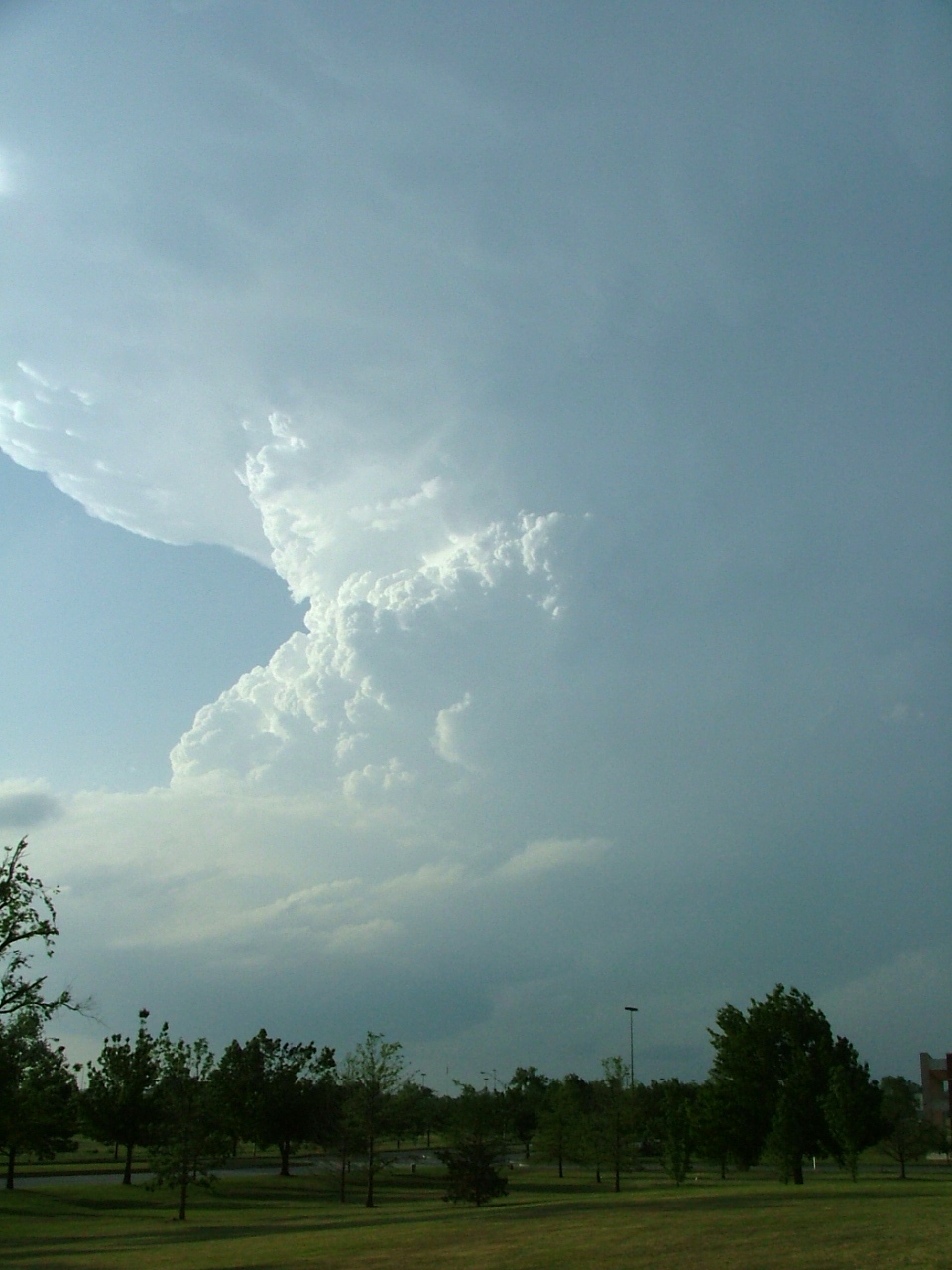
Isolated to scattered supercells developed along the dryline yesterday (May 1) afternoon across central OK. In particular, a supercell began to develop just west of Norman by around 615 pm, moving northeastward and producing large hail (plenty of 1.5-1.75" reports, isolated up to 3") across the east part of the OKC metro by 7 pm, including the Midwest City area. Above is a picture of the backside of this supercell -- looking north/northwest from Norman just as it began producing some of the larger hail. A vigorous updraft and impressive backsheared anvil are evident in the middle to upper part of this supercell storm.
posted by Jared Guyer at 2:32 PM
![]()

1 Comments:
Nice updraft, Guyer... Hopefully, we'll see more of those in a few weeks!
Post a Comment
<< Home