May 13 Chase
More pics coming soon...
Chased with: Jon Racy and Mark Darrow
Base Support: None
Target: Childress, TX to Altus, OK
Mileage: 510 miles
Storm Reports
Tornado Watch 269 / Tornado Watch 273 / Tornado Watch 274
SPC MD858 / MD864 / MD868 / MD871
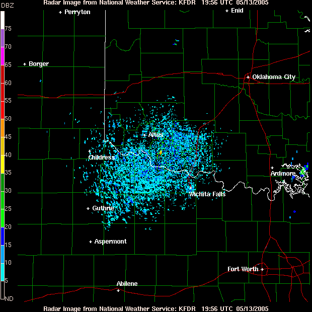
KFDR Radar Loop (southernmost cell on radar)
Summary by Jon Racy: Jared Guyer, Mark Darrow and I had the day off and drove to Altus by 430pm. We were encouraged by the backed low-level flow into NW TX and mid 60s dew points/steep low-level lapse rates per the mesonet obs and SPC objective analyses, especially given the storm initiation south of CDS.
We intercepted the NE flank of the storm on US70 east of Crowell noting wicked anvil CGs and the rain-free base distant southwest. We made it to Rt 6 and blasted south, stopping several times between the Foard/Knox county line to Benjamin (tons of chaser convergence).
It was tough from our vantage point to see much in the way of low-level structure during most of the storm life cycle. But, between 625-630, we did view semi-interesting "clear slots" wrapping around apparent mesos...one just east of Rt 6 looking NE toward Benjamin and one due NW between Truscott/Benjamin. The westernmost feature quickly faded, but the eastern meso, producing a small funnel, became quickly wrapped in rain/hail with considerable brownish/red dust intermixed. Not sure that is what Gene/Jim saw, but at the time, we couldn't clearly indicate whether there was a rain-wrapped tornado there or not. It could have been a contrast thing from our vantage point.
Otherwise, the storm quickly became outflow dominant and we had a tough time staying ahead of the cold outflow. The outflow did produce several short-lived gustnadoes, looking south from Weinert and west of Throckmorton on RT 222/Rt6. We eventually got far enough south to view the front side of the supercell; exhibiting strong HP character with a broad sculpted shelf and jet black pcpn core off to the NW-N.
Interesting to note the obs of near 60F dew points vcnty this storm and probably partially explains the propensity for outflow domination. We wonder if the weakening deep layer shear in NW TX with time may have mitigated the tornado threat somewhat as well.
Also interesting to drive past the chase vehicles that were apparently damaged by the giant hail on FRI's PVW supercells. A lot of broken windshields and huge holes in the fiberglass shells! Yikes!
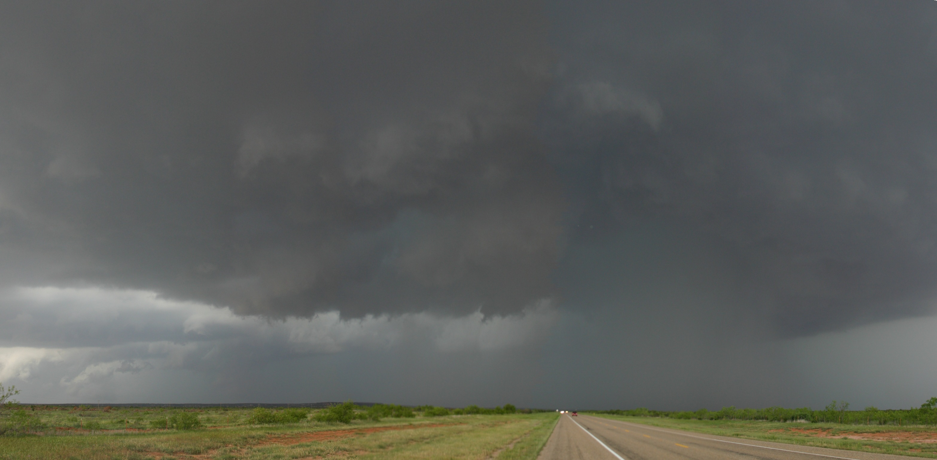
625 pm: Looking N/NW from south of Truscott, TX
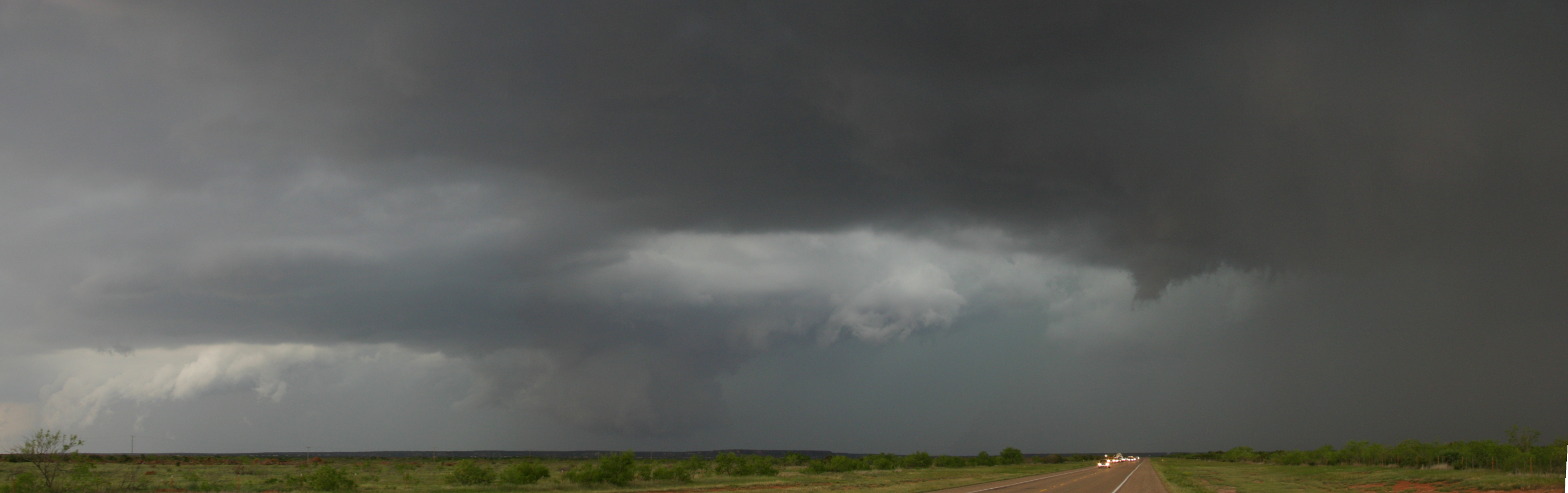
629 pm: Looking N/NW from south of Truscott, TX
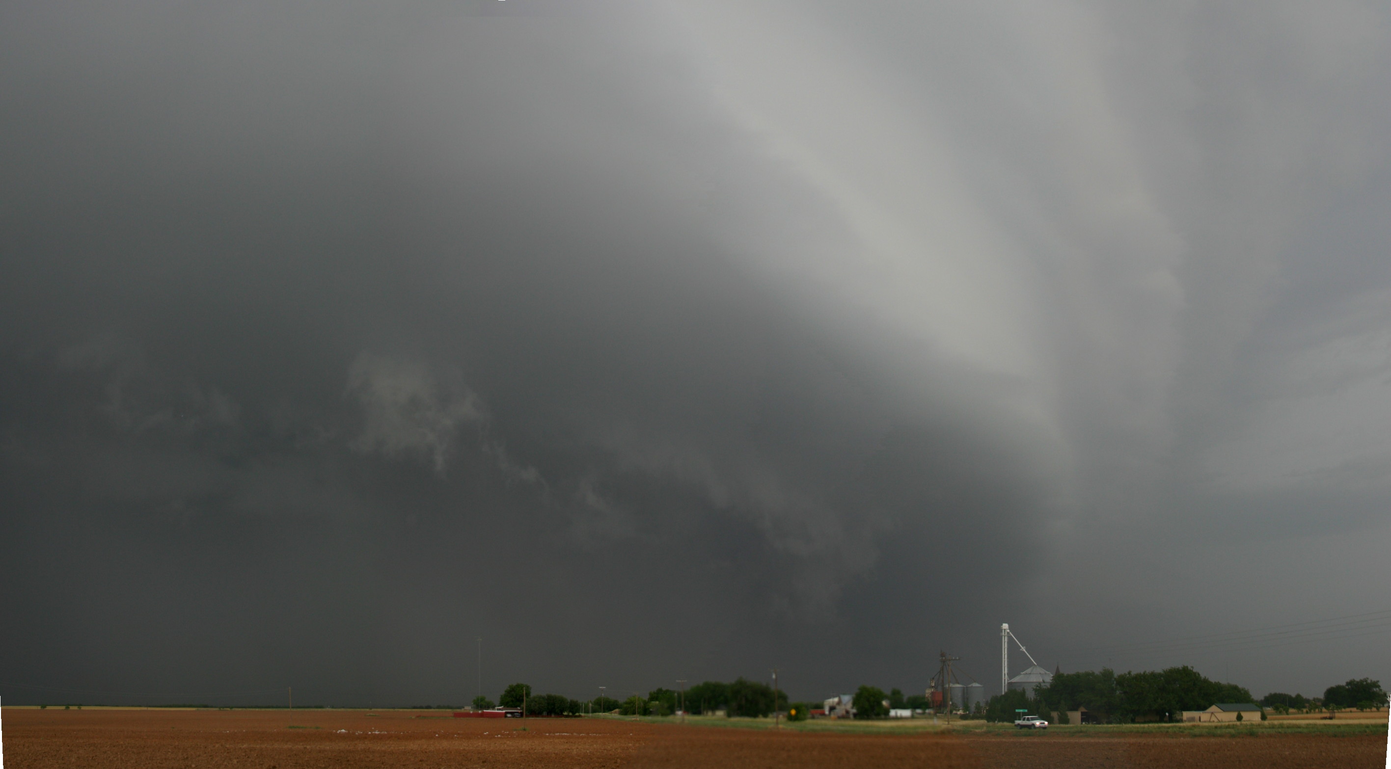
715 pm: Looking N from around Munday, TX
Chased with: Jon Racy and Mark Darrow
Base Support: None
Target: Childress, TX to Altus, OK
Mileage: 510 miles
Storm Reports
Tornado Watch 269 / Tornado Watch 273 / Tornado Watch 274
SPC MD858 / MD864 / MD868 / MD871
KFDR Radar Loop (southernmost cell on radar)
Summary by Jon Racy: Jared Guyer, Mark Darrow and I had the day off and drove to Altus by 430pm. We were encouraged by the backed low-level flow into NW TX and mid 60s dew points/steep low-level lapse rates per the mesonet obs and SPC objective analyses, especially given the storm initiation south of CDS.
We intercepted the NE flank of the storm on US70 east of Crowell noting wicked anvil CGs and the rain-free base distant southwest. We made it to Rt 6 and blasted south, stopping several times between the Foard/Knox county line to Benjamin (tons of chaser convergence).
It was tough from our vantage point to see much in the way of low-level structure during most of the storm life cycle. But, between 625-630, we did view semi-interesting "clear slots" wrapping around apparent mesos...one just east of Rt 6 looking NE toward Benjamin and one due NW between Truscott/Benjamin. The westernmost feature quickly faded, but the eastern meso, producing a small funnel, became quickly wrapped in rain/hail with considerable brownish/red dust intermixed. Not sure that is what Gene/Jim saw, but at the time, we couldn't clearly indicate whether there was a rain-wrapped tornado there or not. It could have been a contrast thing from our vantage point.
Otherwise, the storm quickly became outflow dominant and we had a tough time staying ahead of the cold outflow. The outflow did produce several short-lived gustnadoes, looking south from Weinert and west of Throckmorton on RT 222/Rt6. We eventually got far enough south to view the front side of the supercell; exhibiting strong HP character with a broad sculpted shelf and jet black pcpn core off to the NW-N.
Interesting to note the obs of near 60F dew points vcnty this storm and probably partially explains the propensity for outflow domination. We wonder if the weakening deep layer shear in NW TX with time may have mitigated the tornado threat somewhat as well.
Also interesting to drive past the chase vehicles that were apparently damaged by the giant hail on FRI's PVW supercells. A lot of broken windshields and huge holes in the fiberglass shells! Yikes!
625 pm: Looking N/NW from south of Truscott, TX
629 pm: Looking N/NW from south of Truscott, TX
715 pm: Looking N from around Munday, TX
posted by Jared Guyer at 1:40 AM
![]()

0 Comments:
Post a Comment
<< Home