April 25 Chase
Chased with: Mark Darrow, Ryan Jewell, and John Massura.
Base Support: None
Target: Northcentral TX along I-35 between Red River and DFW Metro
Mileage: 365 miles
Pictures
Storm Reports
SPC Severe Events Webpage -- 00Z DFW Raob
Radar Mosaic Loop
Moisture-starved scenario made things uncertain into the morning, but observational trends by mid/late morning pretty much convinced us to go. Dewpoints increased quite respectably during the morning owing to vertical mixing/advection -- we were holding out for a 60'ish dewpoint to materialize across N TX by late afternoon (turns out didn't quick make it). While moisture was questionable, kinematics were certainly not the problem with adequate deep layer/low level shear. Rather cold aloft with -15 to -19 at 500 mb centered across NW TX.
We left Norman around 1:45 pm with an initial target in northcentral TX along I-35 north of Dallas. As we headed south on I-35, we were generally on western periphery of mid level convection induced rain cooled air. As we neared Ardmore, via data update, became aware that 1) severe watch issued for OK 2) several storms were developing in warmer/steeper lapse rate air west of DFW metro and 3) tornado watch would soon be issued for north/central TX. Given DFW metro logistics (primarily) and additional development to our west (south of Bowie, TX?), we decided to head west out of Sanger, TX after a gas fill-up to watch this development. About 10 miles west of Sanger, while looking for an area to view the back edge of the updrafts, we ran into Rich T. and Corey M.
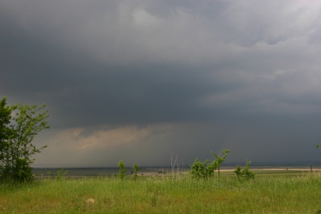
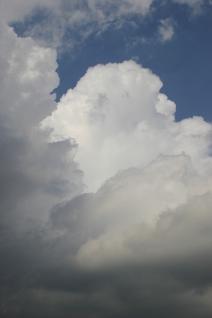
After watching the updrafts become sheared several times over for 15-30 minutes, and seeing an interesting updraft ingest/funny cloud looking feature, we decided to stay with the best development/updraft and followed the storm back east across I-35. Following it all the way to Lake Ray Roberts on Highway 455, it was apparent the storm was increasingly ingesting the previous rain cooled air. With options waning, we ultimately decided to head back west to Sanger and go north on I-35, with hopes of development in the warmer/unperturbed air along the Red River into southcentral Oklahoma. RT to JG: "Why are we heading into the least convective area across the entire southern Plains?!?"
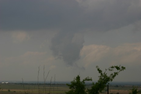
From I-35 as we crossed into Oklahoma, we decided to take our first option west on Highway 32 (separating from Corey/Rich). Several storms has been rather persistent around Wichita Falls over the past hour or two. The storms were rather weak/non-descript with lack of shear evident (as was the case progressively nw into OK). While basically concluding our chase was over and heading back east toward Ardmore/I-35 (on Highway 70) , we drove beneath an increasing core as we reached the west side of Ardmore, with a severe tstm warning subsequently issued. Drifting north on I-35 ahead of the storm, we would encounter up to penny size hail ~5N Ardmore, with 0.5 inch hail common. After spotting Corey/Rich at a scenic overlook, highlight was driving the wrong way up the exit of the overlook to chat with them. Returned to Norman just after 8 pm.
Base Support: None
Target: Northcentral TX along I-35 between Red River and DFW Metro
Mileage: 365 miles
Pictures
Storm Reports
SPC Severe Events Webpage -- 00Z DFW Raob
Radar Mosaic Loop
Moisture-starved scenario made things uncertain into the morning, but observational trends by mid/late morning pretty much convinced us to go. Dewpoints increased quite respectably during the morning owing to vertical mixing/advection -- we were holding out for a 60'ish dewpoint to materialize across N TX by late afternoon (turns out didn't quick make it). While moisture was questionable, kinematics were certainly not the problem with adequate deep layer/low level shear. Rather cold aloft with -15 to -19 at 500 mb centered across NW TX.
We left Norman around 1:45 pm with an initial target in northcentral TX along I-35 north of Dallas. As we headed south on I-35, we were generally on western periphery of mid level convection induced rain cooled air. As we neared Ardmore, via data update, became aware that 1) severe watch issued for OK 2) several storms were developing in warmer/steeper lapse rate air west of DFW metro and 3) tornado watch would soon be issued for north/central TX. Given DFW metro logistics (primarily) and additional development to our west (south of Bowie, TX?), we decided to head west out of Sanger, TX after a gas fill-up to watch this development. About 10 miles west of Sanger, while looking for an area to view the back edge of the updrafts, we ran into Rich T. and Corey M.
After watching the updrafts become sheared several times over for 15-30 minutes, and seeing an interesting updraft ingest/funny cloud looking feature, we decided to stay with the best development/updraft and followed the storm back east across I-35. Following it all the way to Lake Ray Roberts on Highway 455, it was apparent the storm was increasingly ingesting the previous rain cooled air. With options waning, we ultimately decided to head back west to Sanger and go north on I-35, with hopes of development in the warmer/unperturbed air along the Red River into southcentral Oklahoma. RT to JG: "Why are we heading into the least convective area across the entire southern Plains?!?"
From I-35 as we crossed into Oklahoma, we decided to take our first option west on Highway 32 (separating from Corey/Rich). Several storms has been rather persistent around Wichita Falls over the past hour or two. The storms were rather weak/non-descript with lack of shear evident (as was the case progressively nw into OK). While basically concluding our chase was over and heading back east toward Ardmore/I-35 (on Highway 70) , we drove beneath an increasing core as we reached the west side of Ardmore, with a severe tstm warning subsequently issued. Drifting north on I-35 ahead of the storm, we would encounter up to penny size hail ~5N Ardmore, with 0.5 inch hail common. After spotting Corey/Rich at a scenic overlook, highlight was driving the wrong way up the exit of the overlook to chat with them. Returned to Norman just after 8 pm.

